

WHAT IF…? FICTIONAL MAPS
What if France became a ‘hydrocracy’?
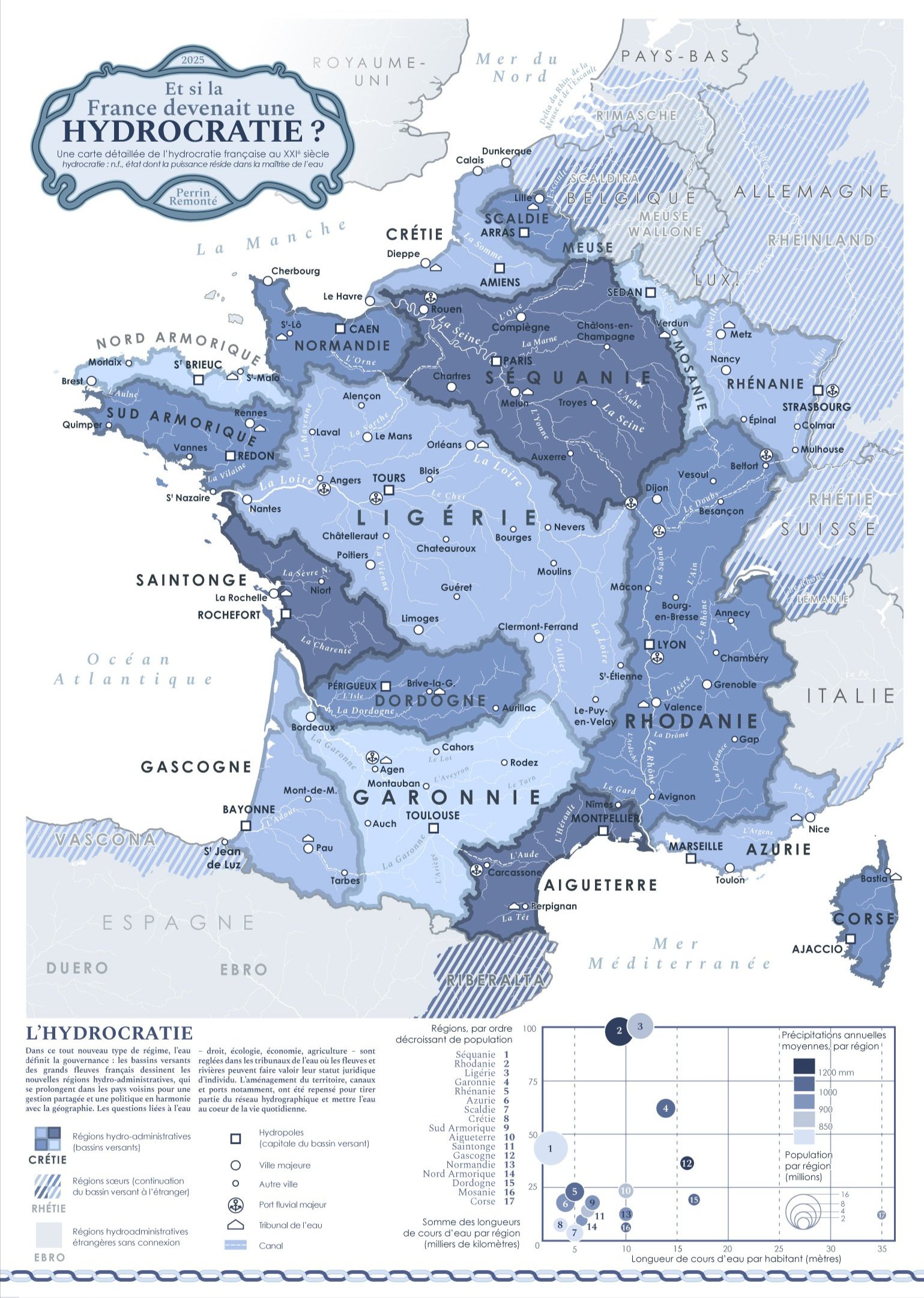
In 2025, we have democracies, oligarchies, autocracies, theocracies and recently idiocracies, so why not create a new term for this new type of water-based governance?
I'm taking some liberties here: the word is a neologism coined for my map, but we do have "Thalassocracy" in the French / English language (a state whose power is based mainly on domination of the sea), so why not extend the idea to rivers, lakes and streams? That's what this map shows!
The motto of this new country? Perhaps "Regenerate, renaturalise, let it flow". In this country divided into hydro-administrative regions (based on catchment areas), water is at the heart of planning and leads the way for our thinking, actions, how we approach geography and how we get around. It is a profoundly decentralised state since issues are now thought out and reflected upon within these hydrological territories, from upstream to downstream, from the sky to the Earth and vice versa, and no longer from a national capital.
This governance strives to preserve water as a natural, economic and cultural common good, going so far as to grant waters - lakes, rivers, wetlands and streams - a legal personality to defend and maintain them, in line with the vision defended by Charlène Descollonges (hydrologist) and Marine Calmet (environmental lawyer), for example, whose work I admire.
This decentralisation does not stop at the country's borders (which are partly catchment basin boundaries): the Rhine continues its course into Germany, the Meuse into Belgium, and this requires cooperation between neighbouring hydro regions! So the Swiss Rheinland, the French Rhineland and the German Rheinland are perhaps as closely linked as other regions in their respective countries.
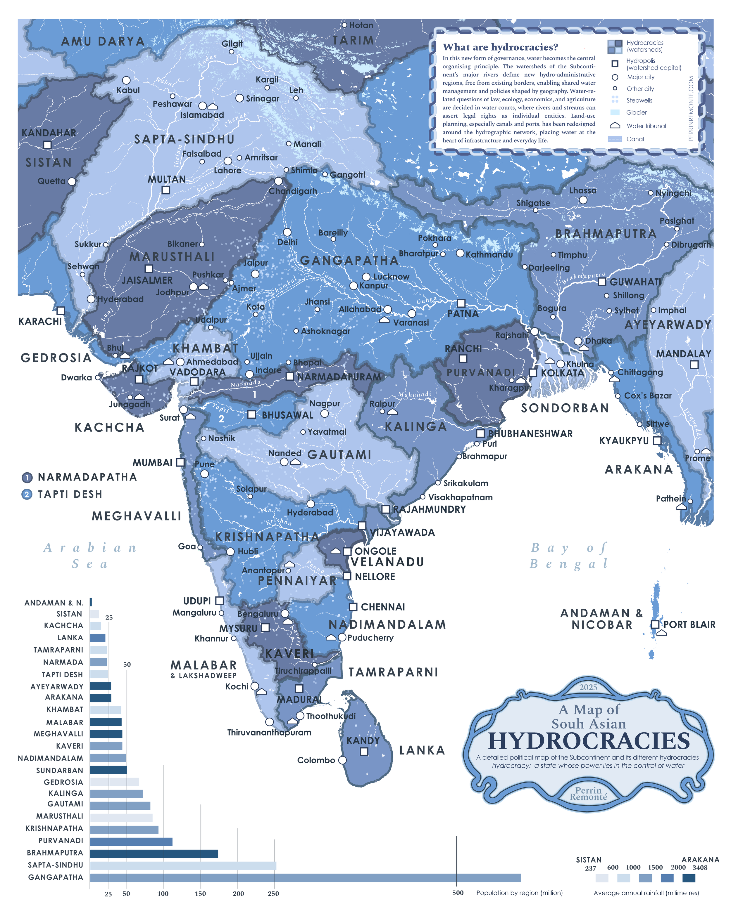
What about South Asia?
What if forests turned into mountains?
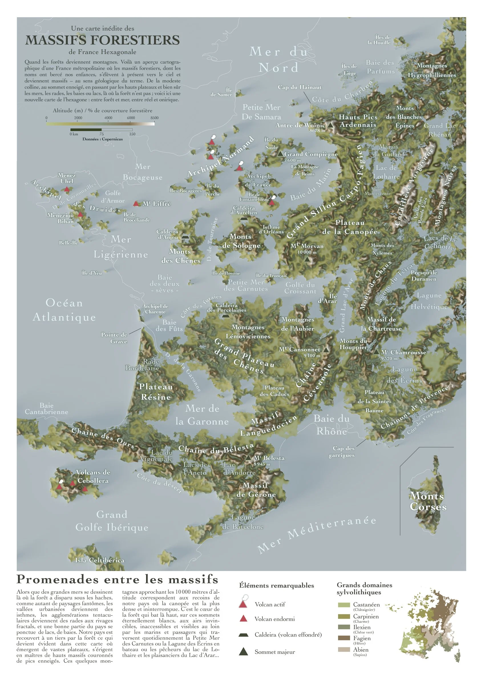
When forests become mountains! The pun works only in french: forest can translate to ‘massif forestier’ which can be understood with a bit of imagination as a massif, a mountain range. So here is a cartographic overview of metropolitan France, where the forest ranges whose names have been part of our childhoods now rise up towards the sky and become mountain ranges—in the geological sense of the term. From modest hills to snow-capped peaks, high plateaus and, of course, seas, harbors, bays and lakes, where there are no forests, here is a new map of France: between forest and sea, between reality and fantasy.
The data comes from Copernicus, the European data service. In this case, the data I used represents forest cover density. At 0% we have 0 meters (the sea) and at 100% we have a 10,000-meter mountain.
Unsurprisingly, forests and mountains largely overlap in mainland France, but not only there. Indeed, some areas hold surprises with ancient and very dense forests: the forests of Compiègne, Tronçais, Sainte Baume, Chartreuse, and Landes.
What if all the
glaciers melted?
Mainland France
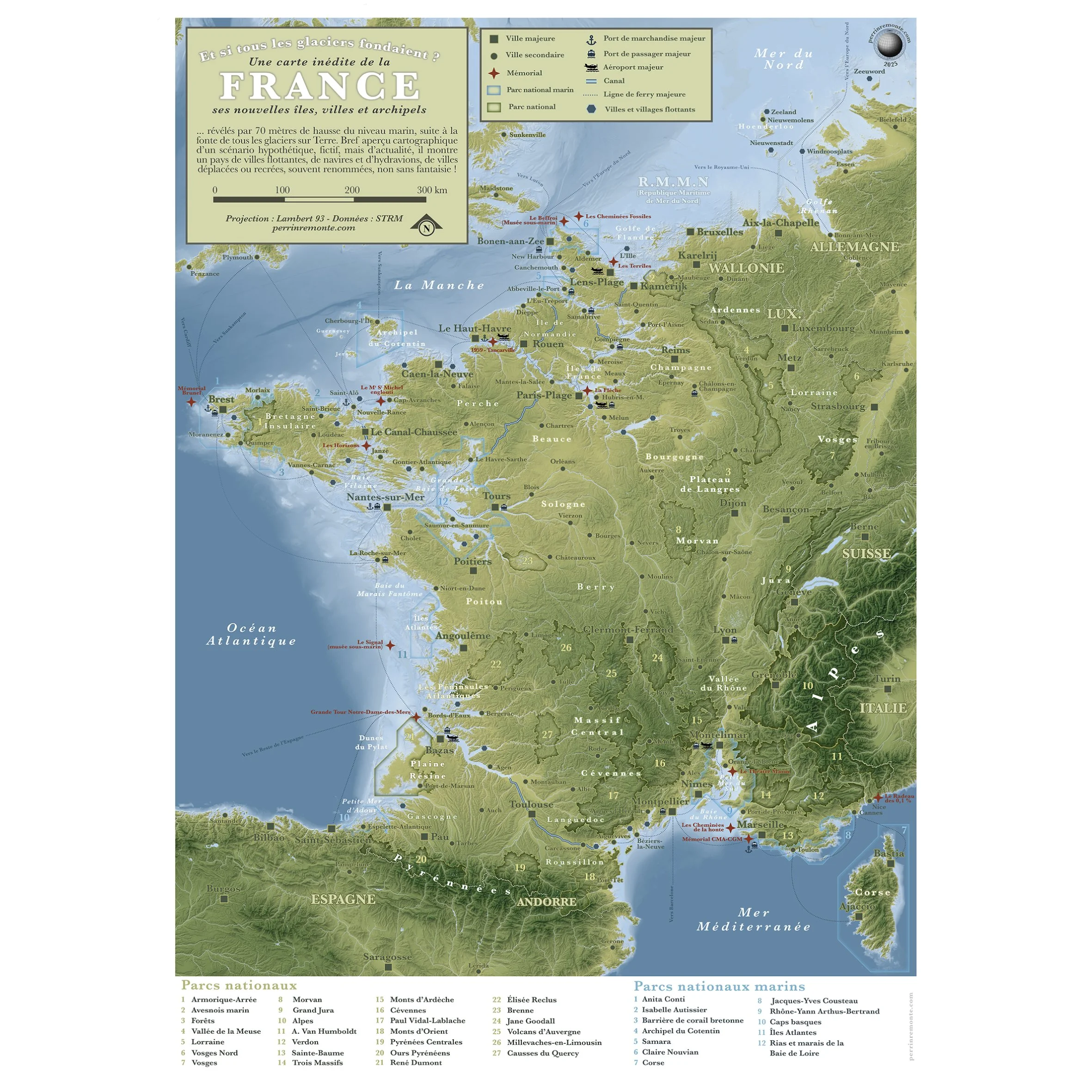
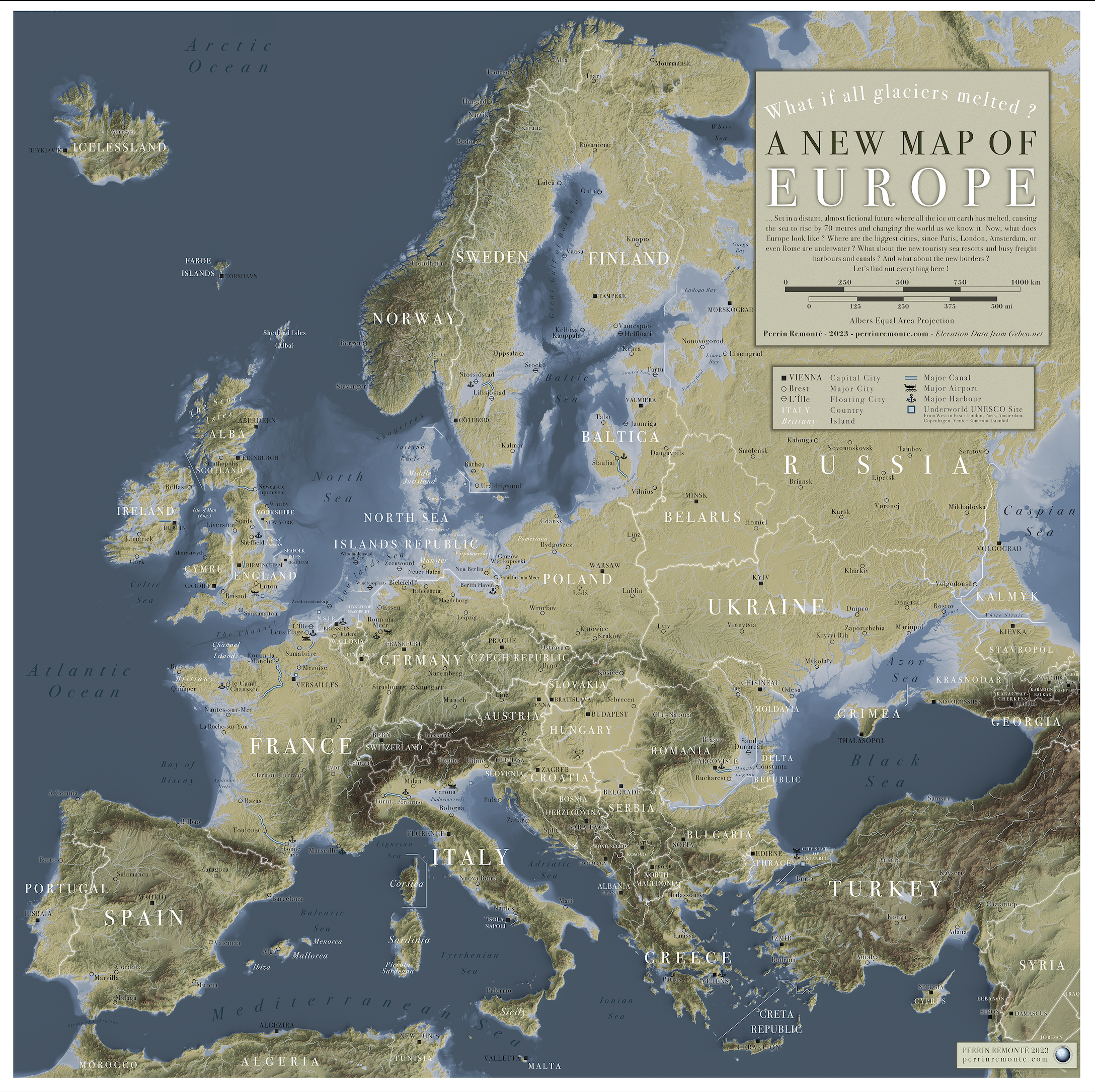
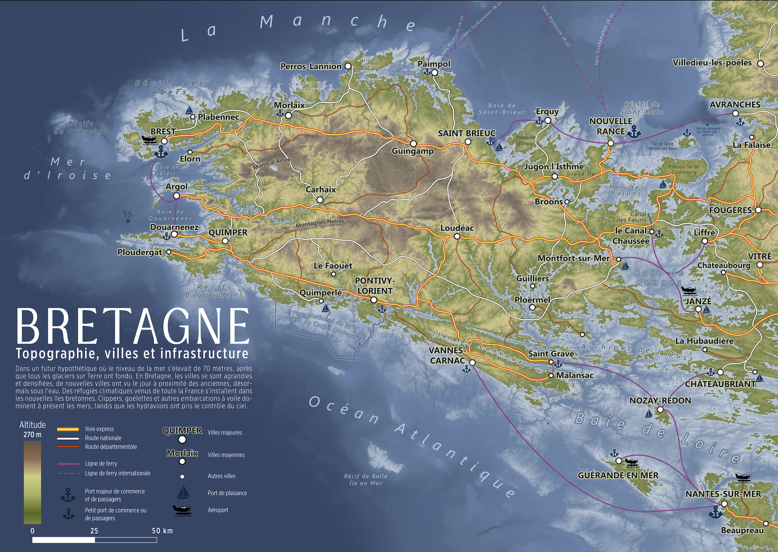
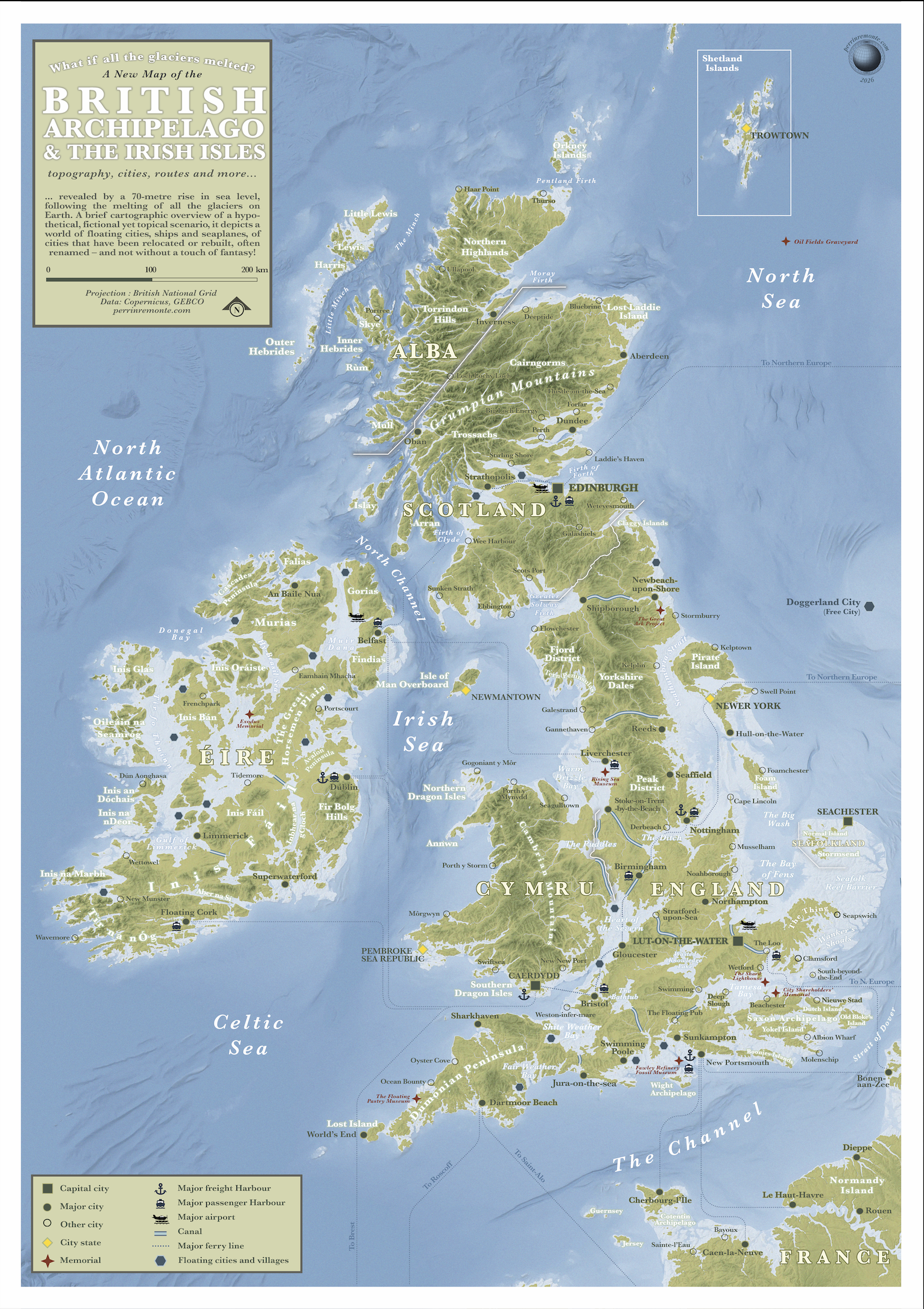
Discover a visual illustration of this distant and hypothetical yet topical scenario in a series of 10 maps – dive headfirst into 10 maps showing mainland France if all the glaciers melted.
70 meters of sea level rise and a few population shifts later, the maps are here!

I imagined my hometown surrounded by sea ice every winter. Here’s what it could look like

19 January 2025 in Brest: the Rade de Brest is frozen over, as it is every winter.
This morning, I’m going diving in the Rade de Brest. But yesterday, while talking with my teammates about the dive, I had the misfortune of hearing someone mention the Rade de Brest frozen over — sea ice in the bay (as a joke, of course; the water really is cold this time of year!). But it was too late: the idea was simply too tempting not to turn into a map...
So here it is: in an alternate climatic reality (one that would suit me just fine), temperatures in Brest on this 19 January would be hovering around -23°C, and much of the Rade would be frozen over, forming a vast expanse of pristine white sea ice, crossed every day by a public transport network of snowmobile buses and ice-strengthened boats, connecting the different stations across the bay.
Fixed stations: these are the ones built on solid ground.
Floating stations: these drift and shift slightly depending on the seasons, currents and sea ice. They allow passengers to switch seamlessly from bus to boat and travel without limits.
So there would be no need for a car to leave Brest, go for lunch in Daoulas, and then visit a friend in Lanvéoc! Everything could be done across the ice. Though beware of the new predators roaming the frozen bay...
Because saltwater freezes at a lower temperature than freshwater, and because stronger currents are found in the centre of the Rade towards the Goulet, it is likely that the sea ice would be thinner, less extensive or more fractured in the western part of the bay. Not to mention the Abeille Boréale (which could be photographed by Ewan Lebourdais), an icebreaker whose daily mission would be to keep a passage open between the Brest Arsenal and Île Longue, two crucial sites for military activity in Brest and across France.
And with that, I’ll leave you to imagine what life in Brest — or anywhere else in France — might look like in a climate like this!
What if population became mountains?
Cities would be mountains, deserted countryside would be lakes or even seas…
Here’s my attempt at showing this alternate geography!


What if rivers turned into tree?

See the entire series below, with 24 great rivers from all continents!
A map of the mediterranean, but inverted
