Following on from a map of the « Wild North of Europe », Fennoscandia, this summer, I took on the next challenge and started mapping the wilderness of the British and Irish Isles: forests, peatlands, meadows, rivers, national parks, marine forests, animal and plant species, and rewilding projects. have tried to offer a rich overview of the more or less unspoilt natural treasures found across this myriad of islands across the Channel, from Kent to Donegal, from Cornwall to the Shetlands, and from the Fenlands to the Cambrian Mountains.
Each map is printed in Cambridgeshire, in an artisanal studio and edited in 20 copies, A2 format (42×59,4 cm). They are all signed, using archival ink and paper for a museum grade copy you can frame and hang at home.
NB: the map will be shipped after after making sure it’s error-free
Following on from a map of the « Wild North of Europe », Fennoscandia, this summer, I took on the next challenge and started mapping the wilderness of the British and Irish Isles: forests, peatlands, meadows, rivers, national parks, marine forests, animal and plant species, and rewilding projects. have tried to offer a rich overview of the more or less unspoilt natural treasures found across this myriad of islands across the Channel, from Kent to Donegal, from Cornwall to the Shetlands, and from the Fenlands to the Cambrian Mountains.
Each map is printed in Cambridgeshire, in an artisanal studio and edited in 20 copies, A2 format (42×59,4 cm). They are all signed, using archival ink and paper for a museum grade copy you can frame and hang at home.
NB: the map will be shipped after after making sure it’s error-free


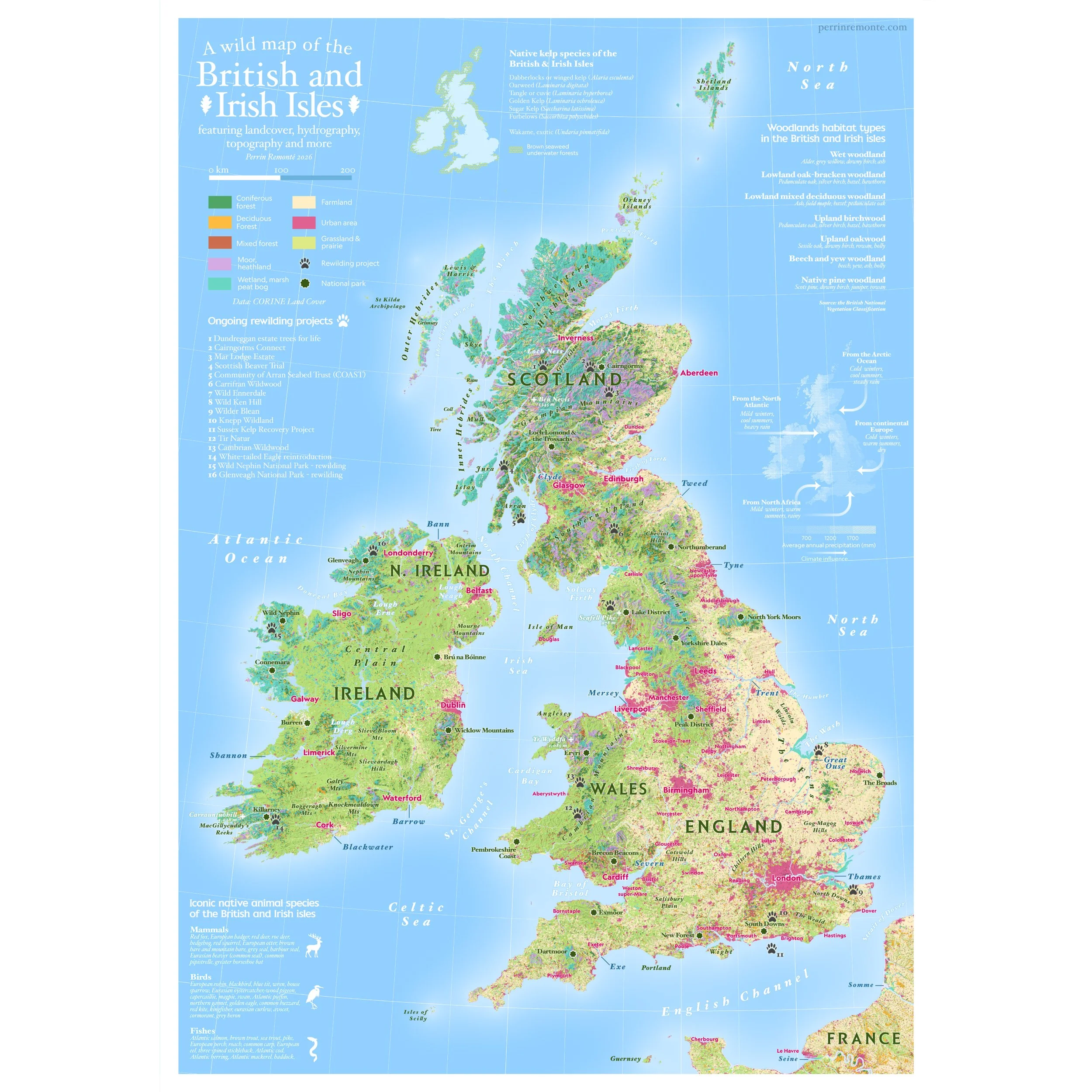 Image 1 sur 6
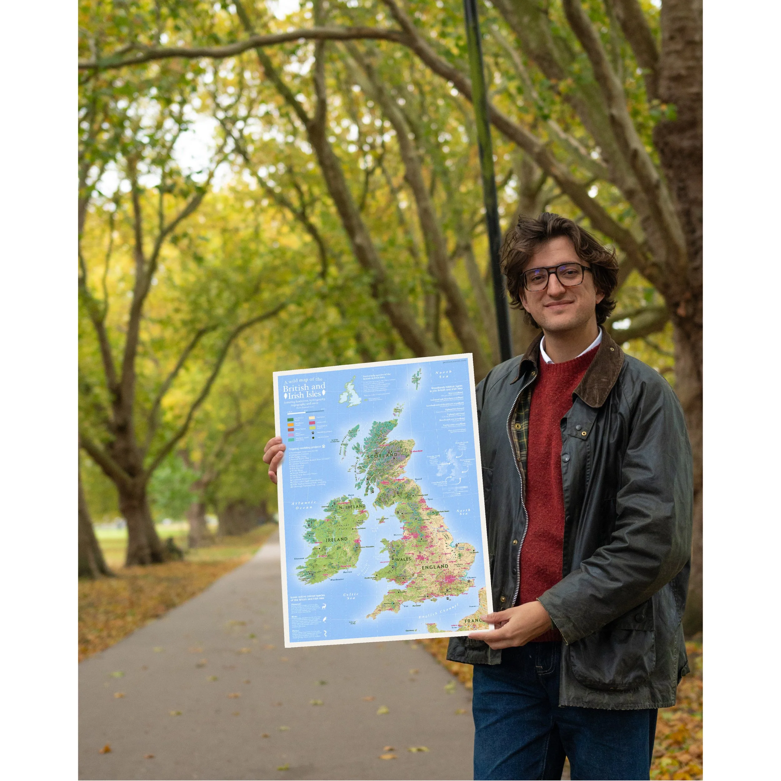 Image 2 sur 6
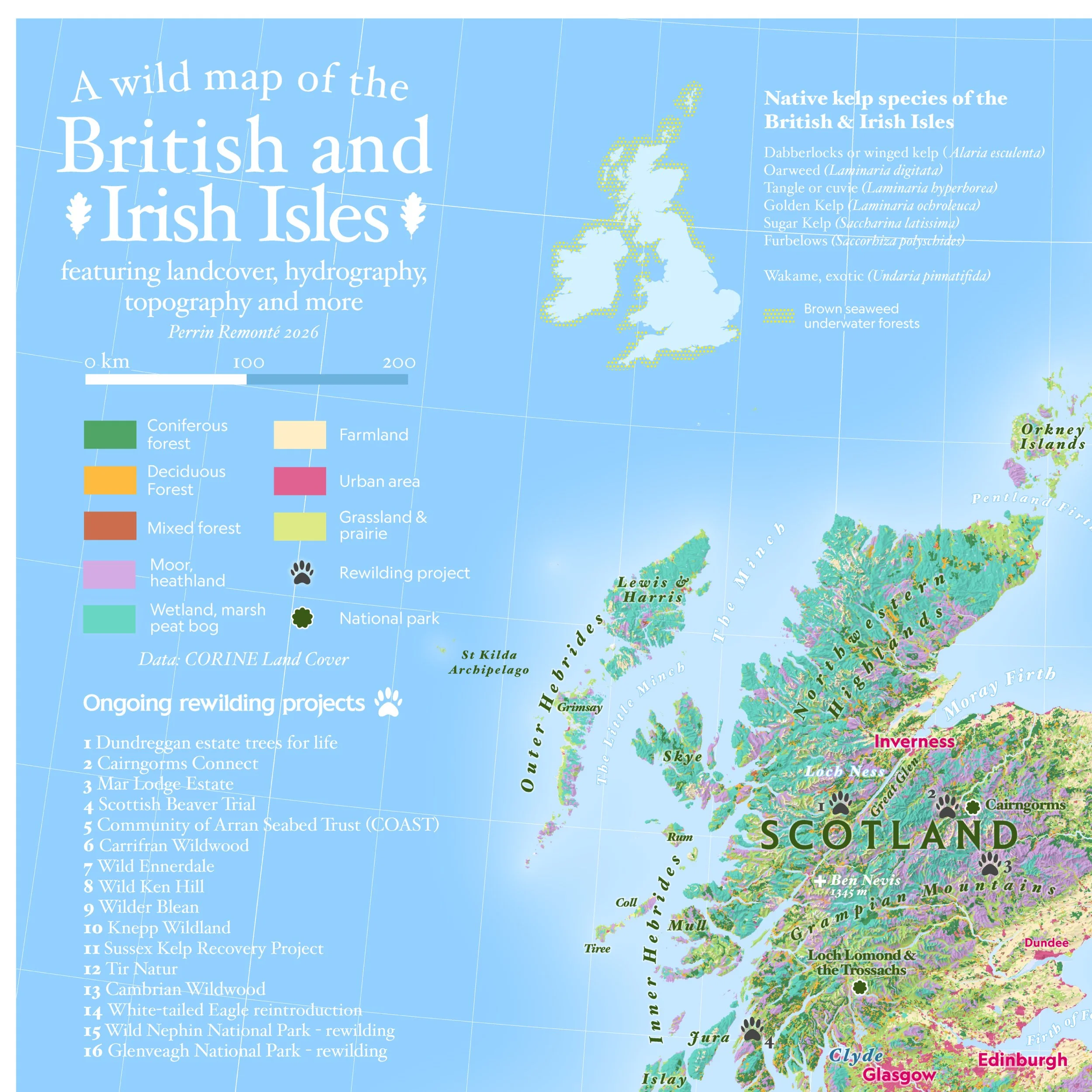 Image 3 sur 6
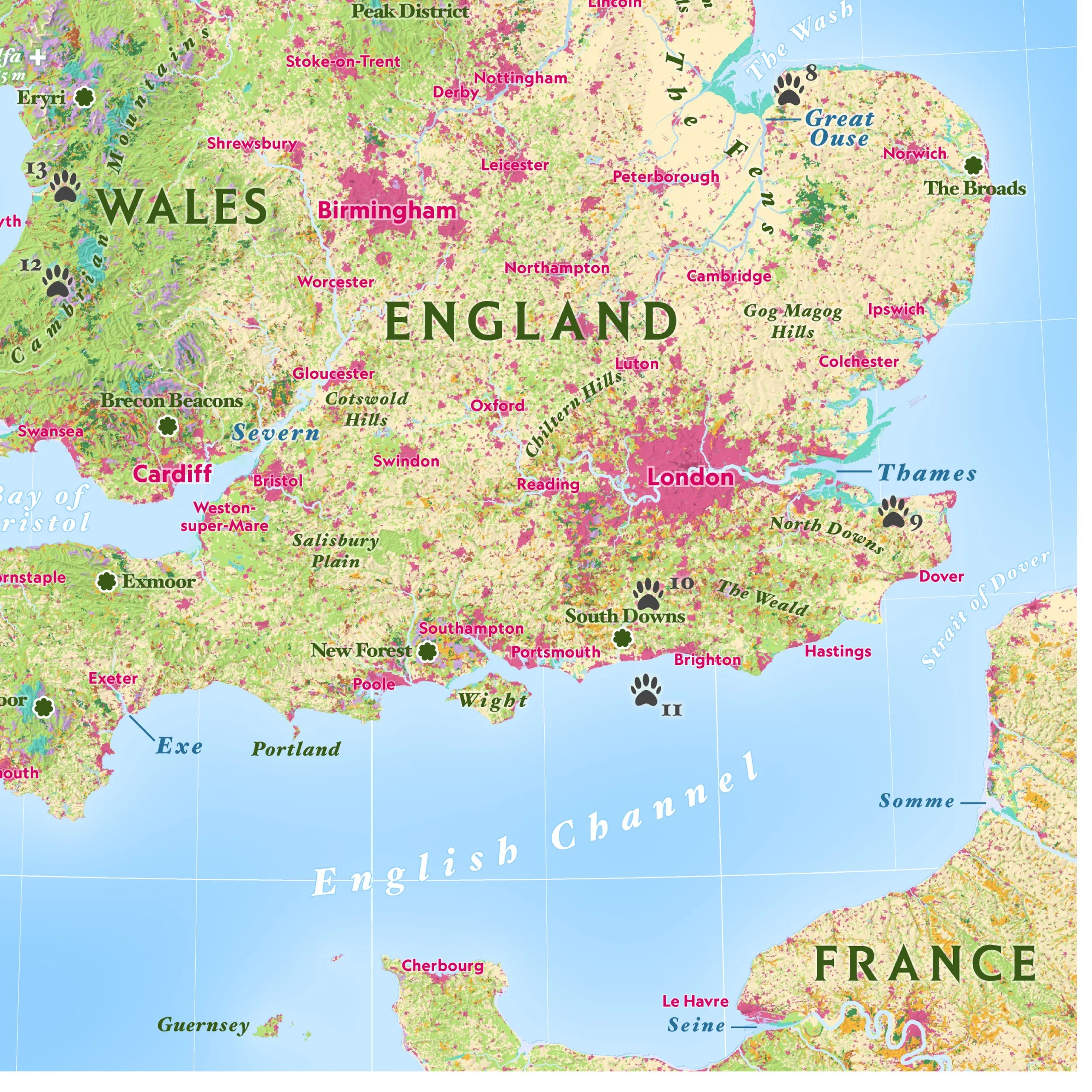 Image 4 sur 6
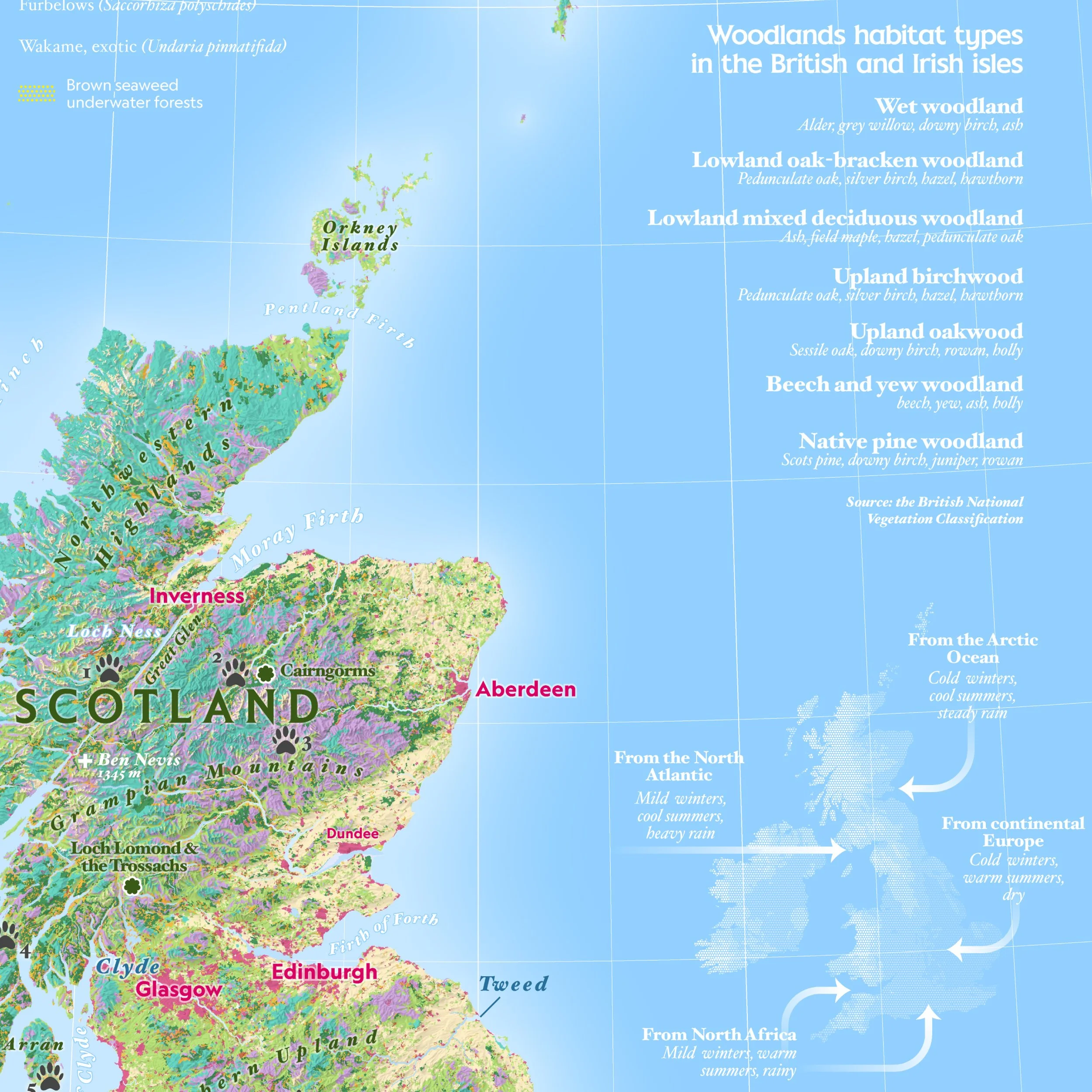 Image 5 sur 6
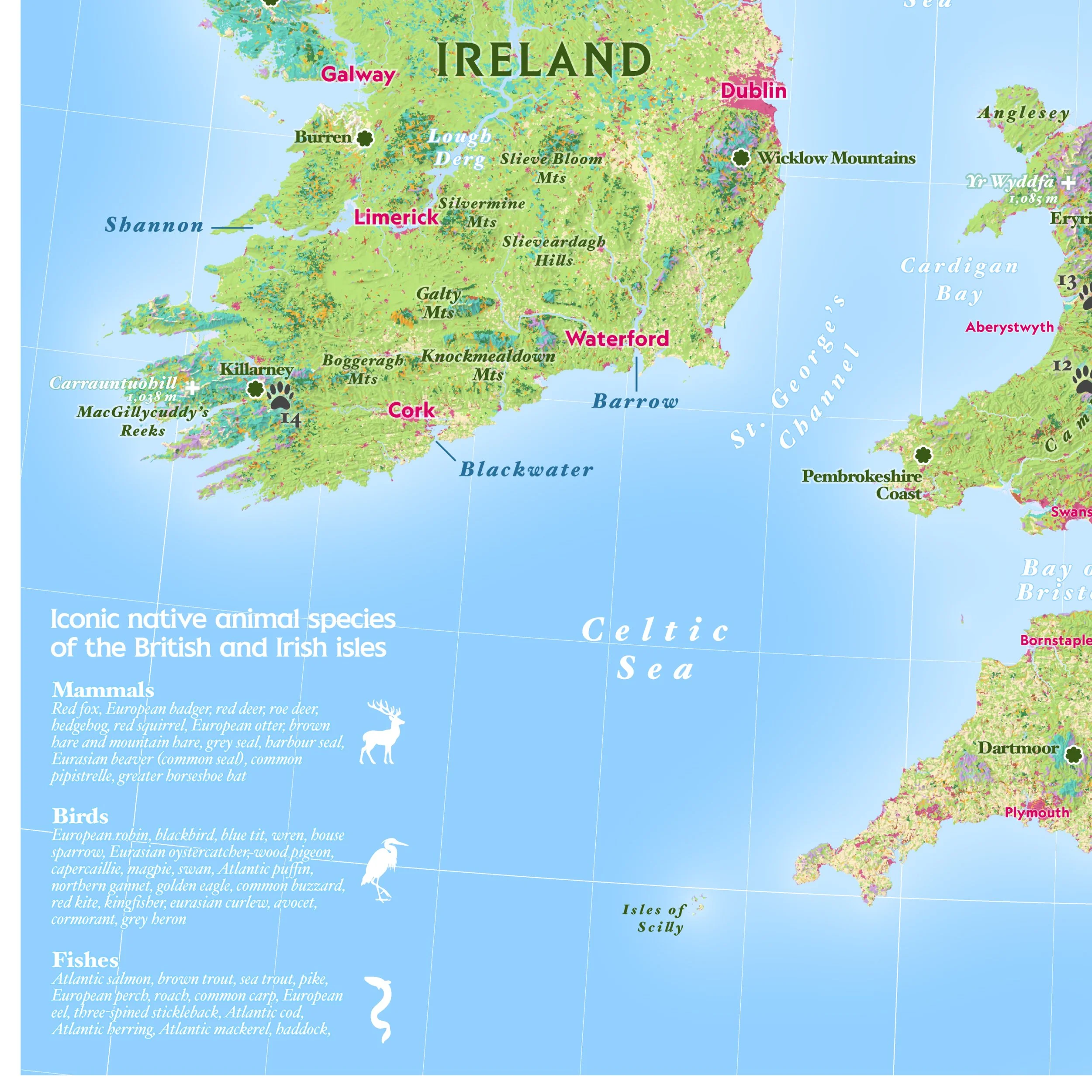 Image 6 sur 6