Maps from South Asia —
Maps from South Asia —
A gallery of maps celebrating the geography and beauty of the Subcontinent
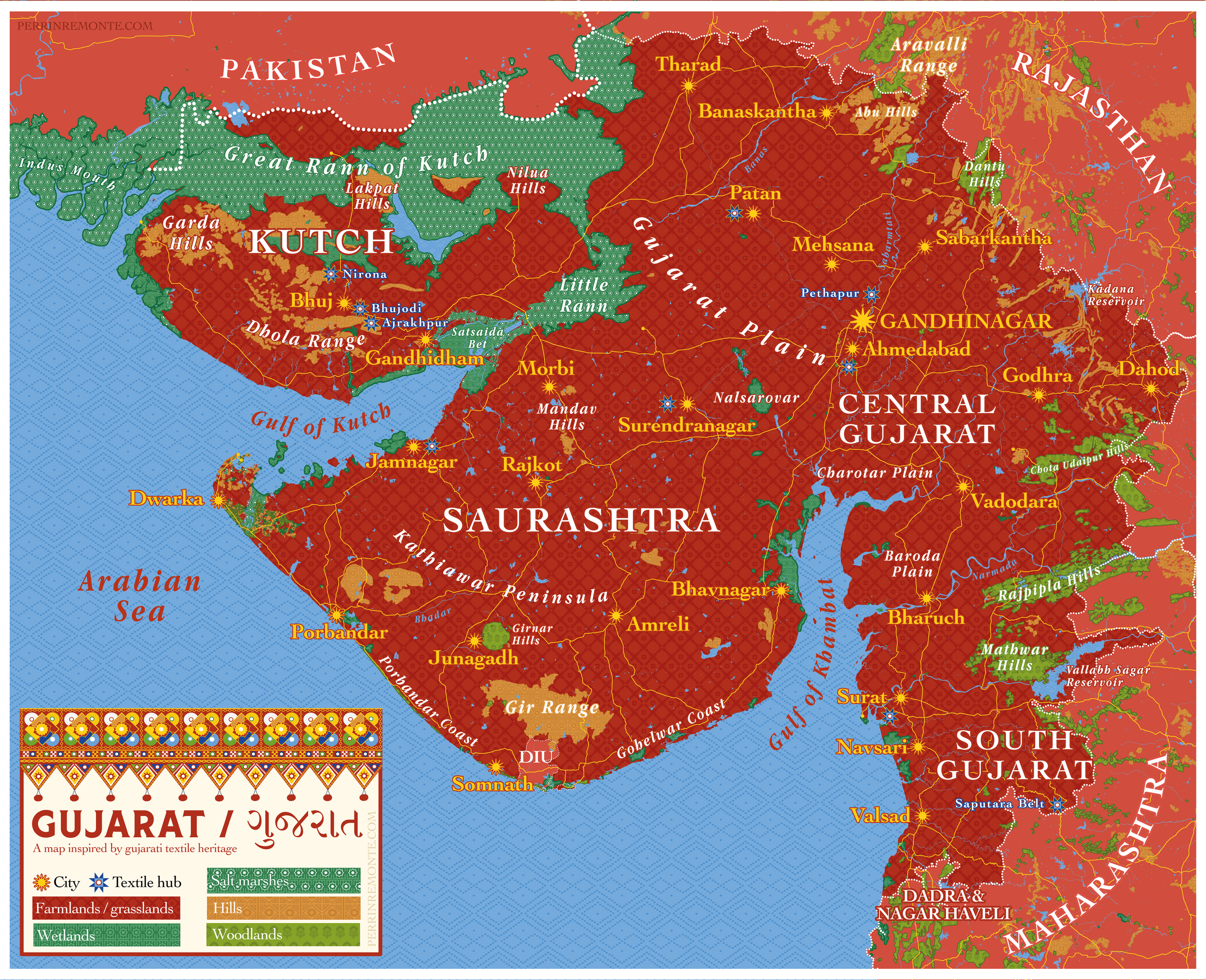
I had the chance of visiting Gujarat in february 2026, a region I was longing to see after reading and hearing so much about its marvellous textile heritage, still going strong today.
Visiting textile workshops and shops around Ahmedabad and Bhuj, seeing all these patterns, texture, visual elements elegantly blended together on a single frame by skilled craftpeople really triggered something in me and I wanted to make a map of it, somehow.
I ended doing crafting something too, to channel that obsession of making a map as maximalist and intricate as indian craft can be. A map that celebrates traditional weaving, stitching and block printing patterns found across the state, such as Bandhani, Patola, Ajrakh block print, Toran, kutchi, rebari and nomad embroidery, in this map, all standing for a type of land use.
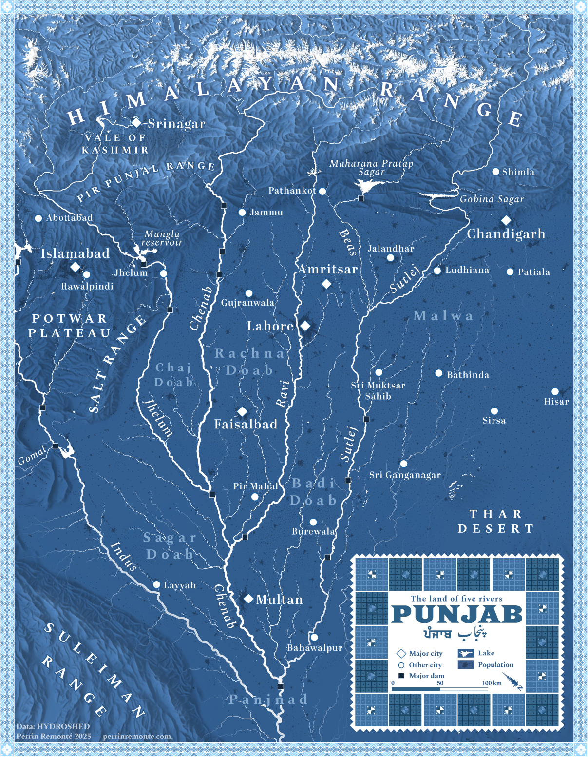
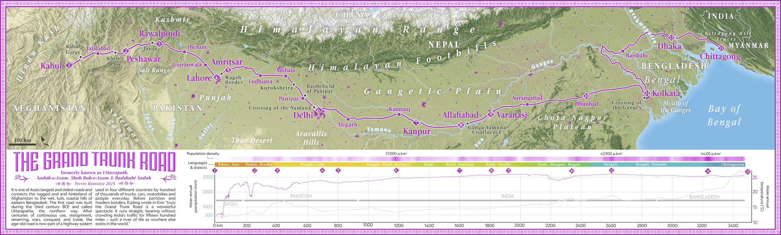
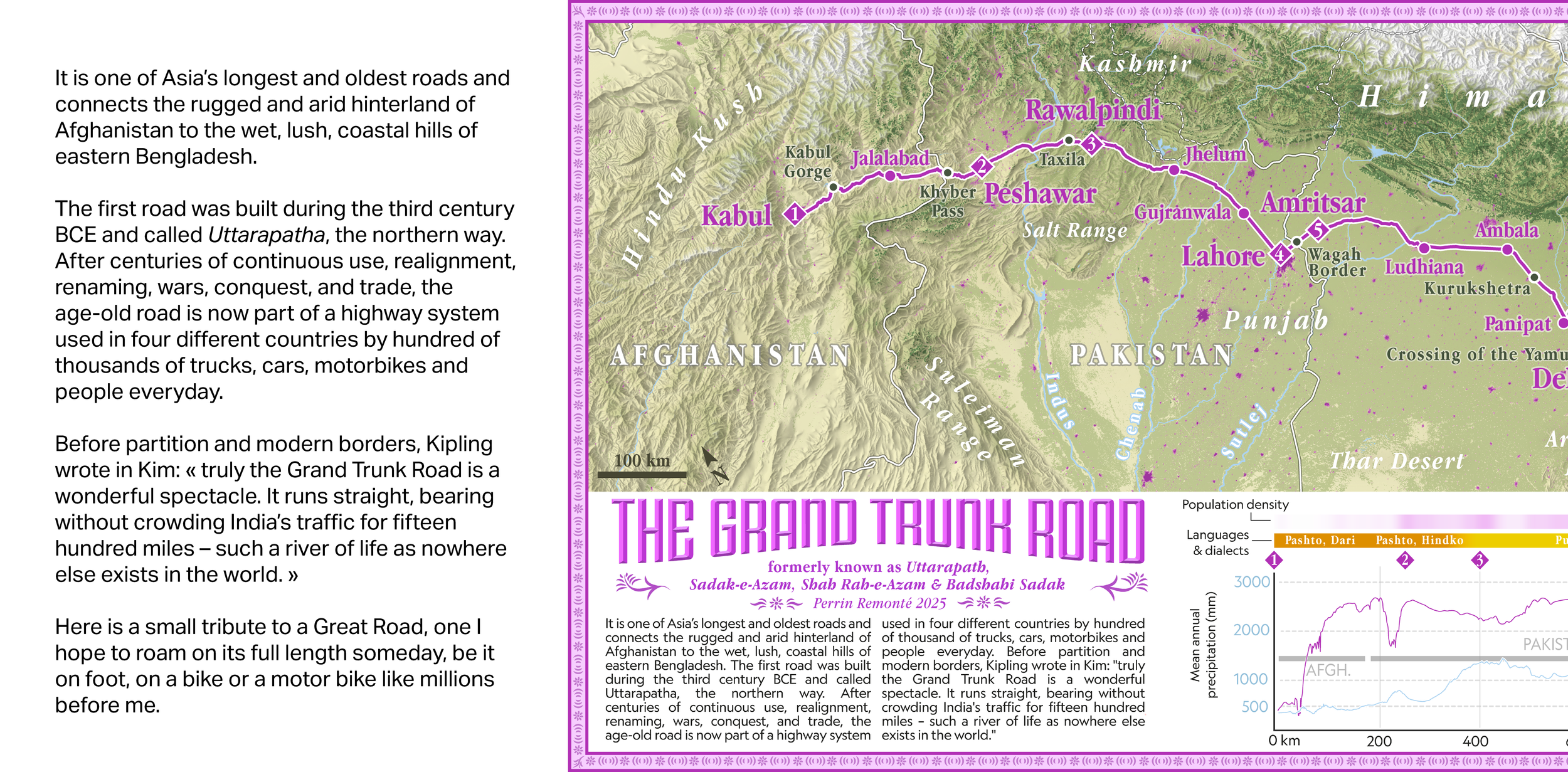
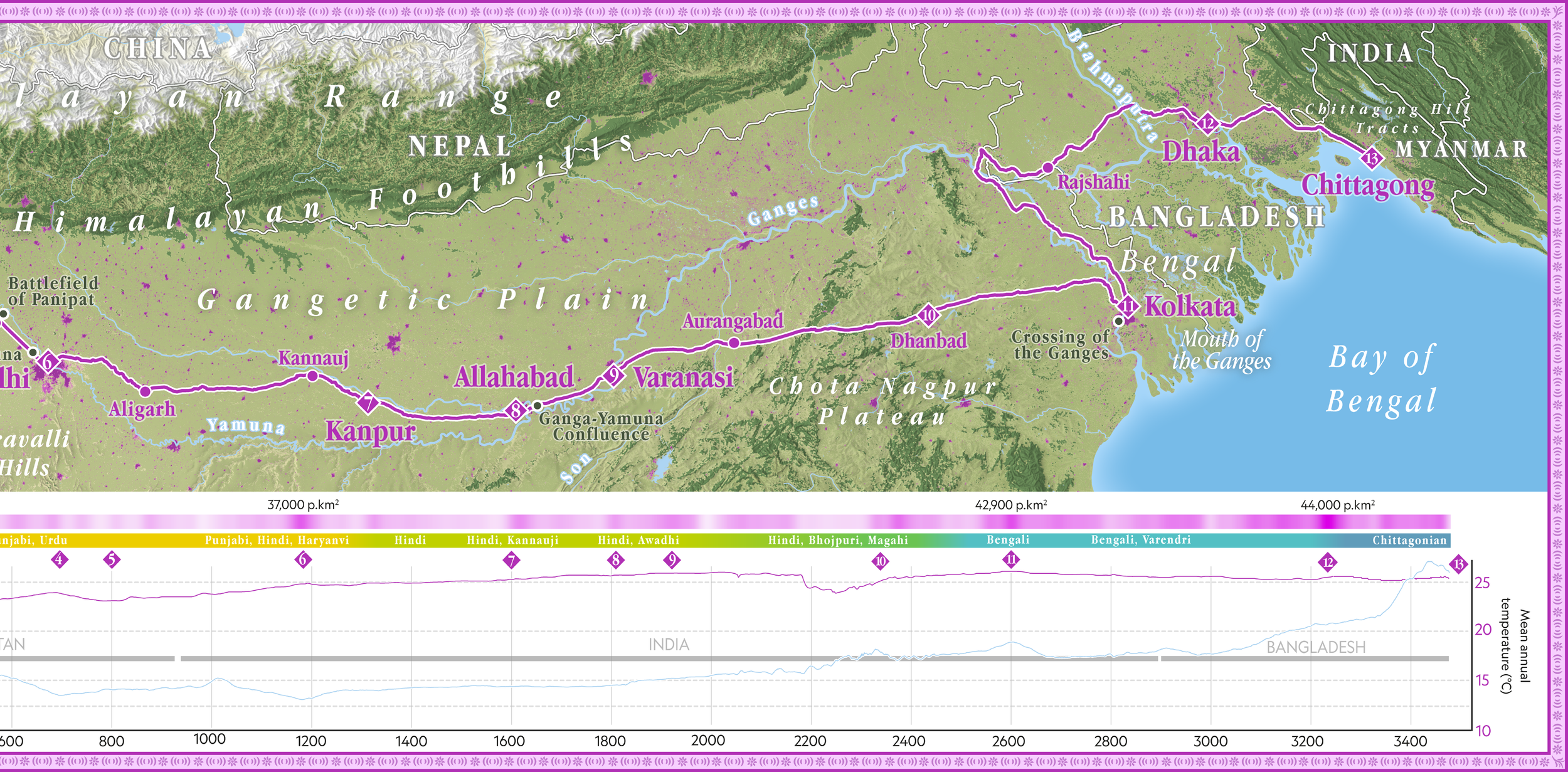
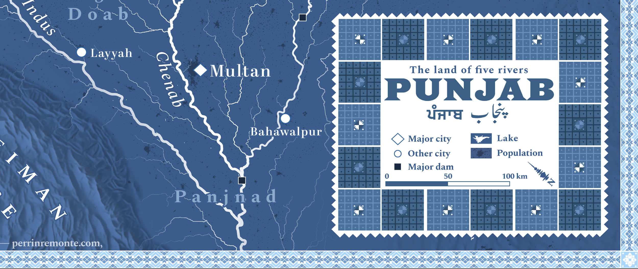
The land of five rivers
Here’s my attempt at making a hydrologically and etymologically accurate map of Punjab, so beautifully and aptly named “the land of five rivers”.
Beas, Ravi, Sutlej, Chenab and Jhelum - and a sixth one, the Indus as an extra guest - form a beautiful and ancient geography that has been evolving through the centuries, with rivers that used to flow, like the Saraswati, and countless canals and human-made waterways created by the british during the Raj.
This tree or rather hand-like water system coming from the mountain is fed by glacial and snow melt, but also monsoon rains and its doab, the tract of land between rivers, is South Asia's breadbasket, thanks to a perfect combination of fertile and irrigated lands blessed with warm climate and hard working farmers.
Tall, towering peaks, arid mountains and plateaus and a desert surround Punjab on three of its side, further enriching its geography and one map is barely enough to unpack all there’s to say and understand about the region.
The map features a Phulkari pattern, a flower embroidery, from Punjab, around the key. Phulkari is a very intricate embroidery work traditionally made by Punjabi women, representing a quintessential punjabi staple, wheat, but stylised in the form of a flower.
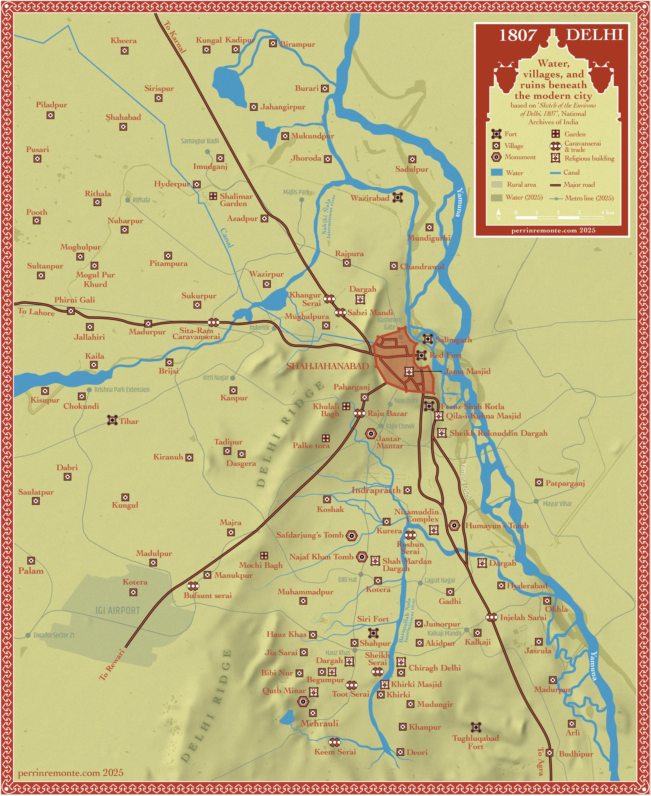
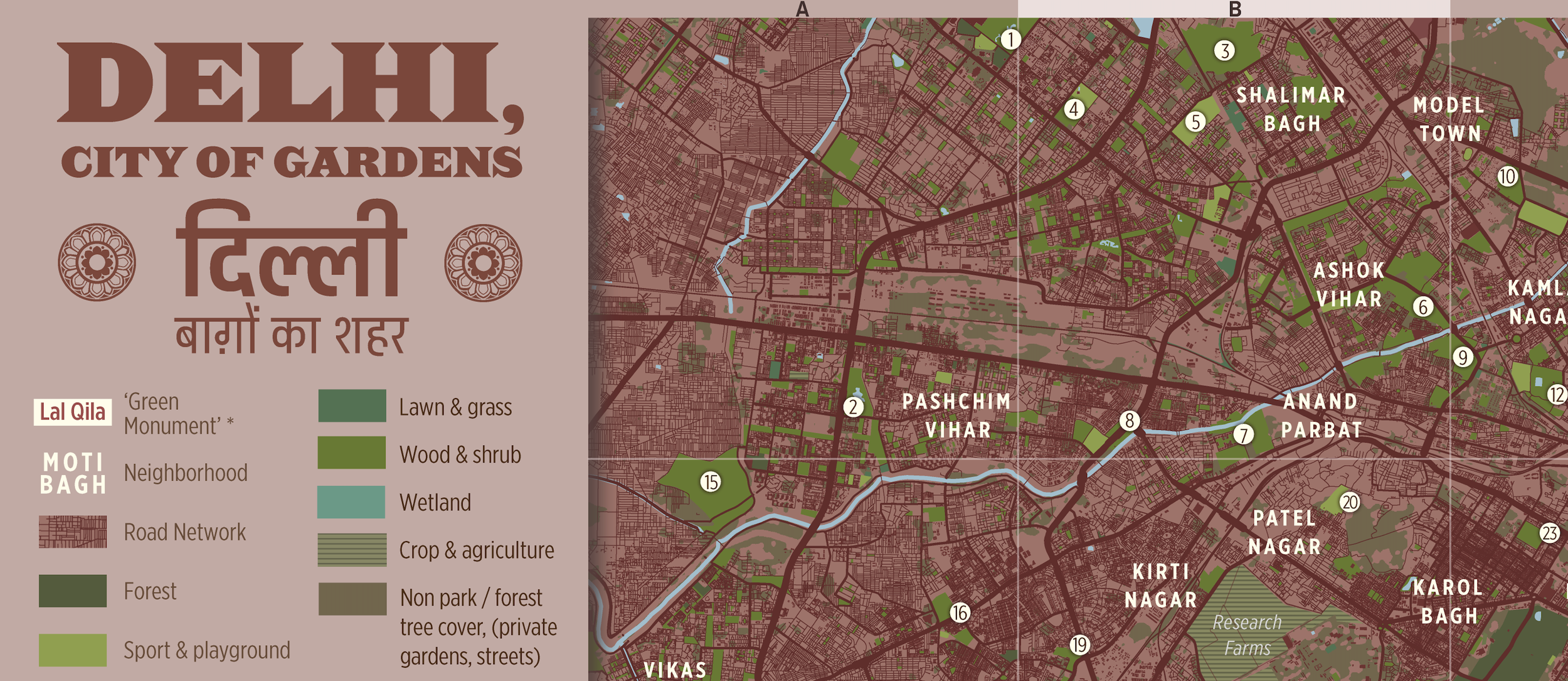
Have you ever wondered what a map of today’s Delhi - the indian capital city, a megacity of 35 million - superimposed with the city, or rather the cluster of cities and villages, that used to exist there in 1807 would exist? Well, here’s your answer.
I blended an old map made by a british military surveyor of Delhi (then Shahjahanabad) and its environ in 1807 with today’s data, water bodies and metro lines to give the reader a sense of scale.
Blending the two not only achieves to show the incredible urban spread that took over the 1807 Delhi region. Indeed, today, most of the map is urban fabric, except for the hills you see in the centre: they’re the 2 billion year old Aravalli mountains.
The map also helps realise that anyone walking in Chanakpuri, Sainik farm, Rohini or taking the metro in Kashmere gate or Delhi Gate is actually stepping on and surrounded by what used to be a mediaeval walled city filled by sufi shrines, abandoned forts, caravanserais and villages spread across the Yamuna plains…
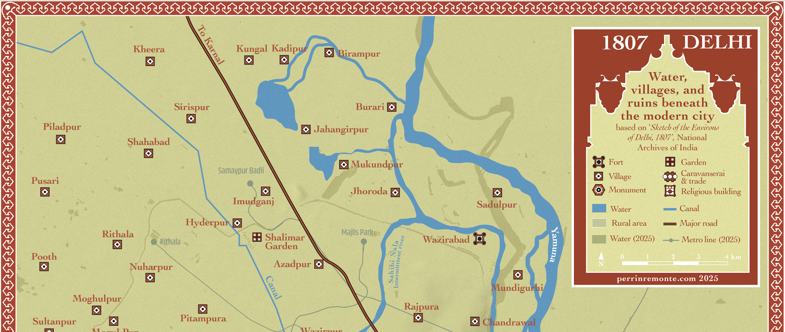
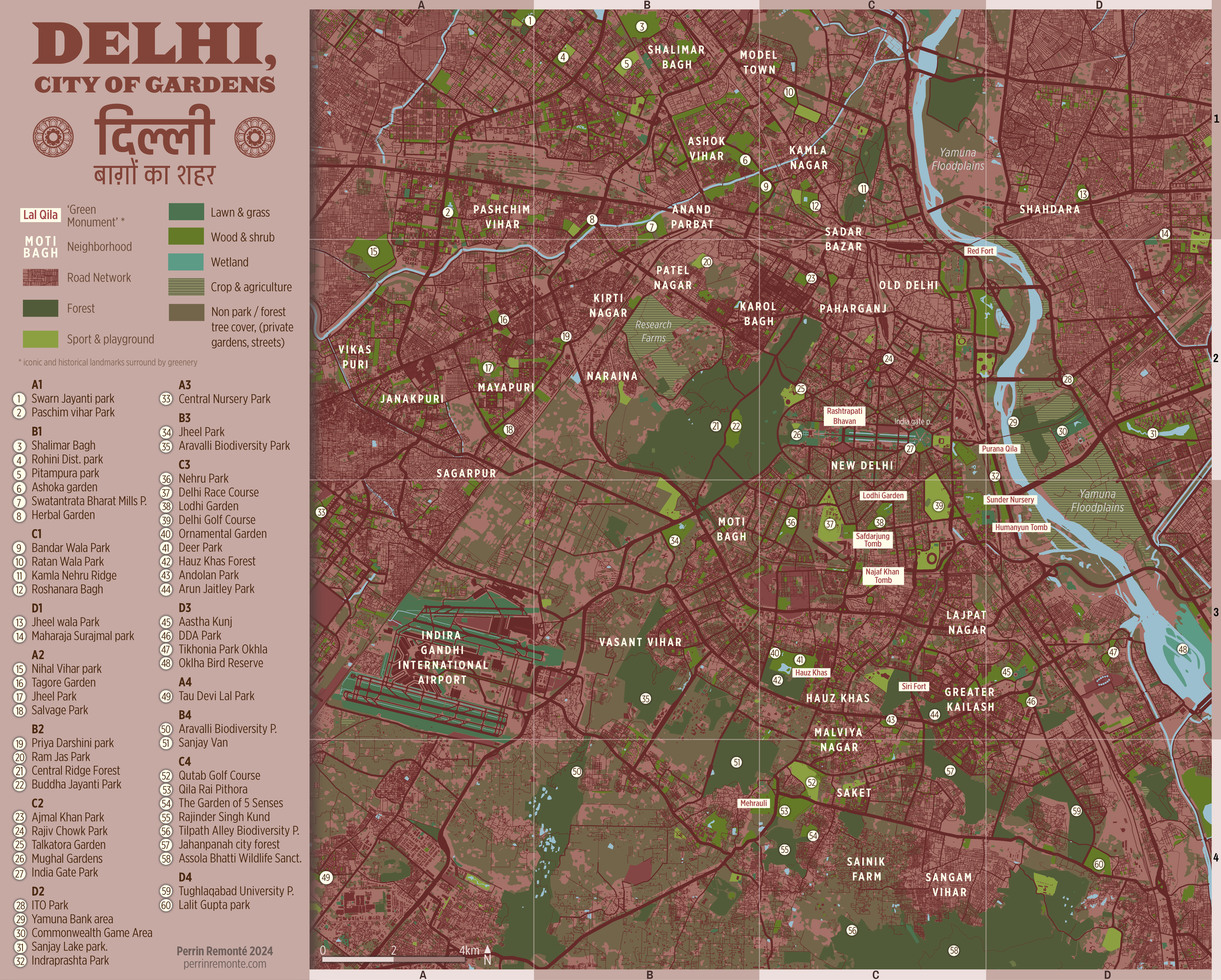
The map mostly features two colours: shades of green for the intense, lush green of Delhi’s gardens and parks - especially during the monsoon - and the earthy, deep shade of red, echoing the red standstone promeninently used by rulers of Delhi for centuries for their mosques and mausoleums.
In april and may 2024, I set for a peculiar adventure in Delhi, one the greenest capitals of Asia: I went after the most iconic, interesting, marvelous, but also hidden, crowded and ordinary parks and green spaces of the city.
My goal was simple. I wanted to document them, what goes in their premises, what people do we find there, what they do, how they do it and how.
Answering all these questions help to understand different things like history, urban planning, social geography, unequality patterns, class divide and the urban heat island phenomenon.
The result of this quest for Delhi’s greenery is a 15 minute read with original maps and photographs you can find here.
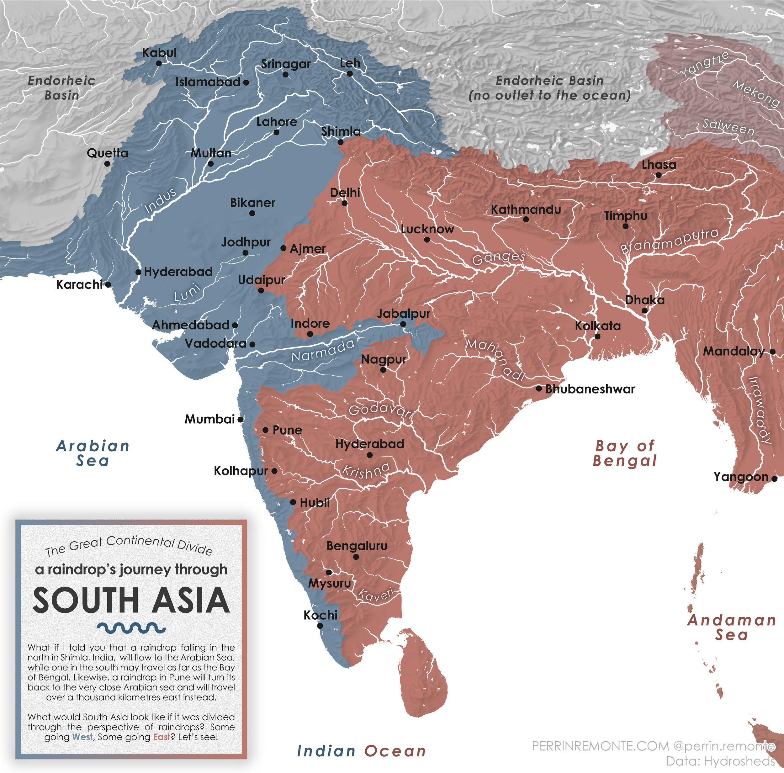
An invisible line runs across South Asia.
From Shimla to Kanyakumari, it divides this vast region into two parts. One side looks toward the Arabian Sea, the other toward the Bay of Bengal.
I am, of course, talking about river catchments, these invisible giants that discreetly take shape, along ridgelines, peaks, and plateaus, giants whose backs we walk on every day, without even noticing it.
And what about the raindrops then? Picture this: a raindrop falling in Leh, Kabul, Shimla, or Jabalpur will eventually end its journey in the warm waters of the Arabian Sea, carried by the legendary Indus, the enigmatic Narmada, and the mountain torrents of the Western Ghats.
Another raindrop, falling in Lhasa, Shimla, Delhi, Pune, or Bangalore, will reach the Bay of Bengal after a journey through glacial valleys, wild meanders, vast lowland rivers, and sprawling deltas. Yes, Shimla shows up twice, no, this is not a mistake. This indian city in the Himalaya enjoys the rare distinction of lying exactly on the boundary between these two immense systems.
So, next time you see a raindrop hitting the ground, just think of the crazy adventure it’s about to begin.
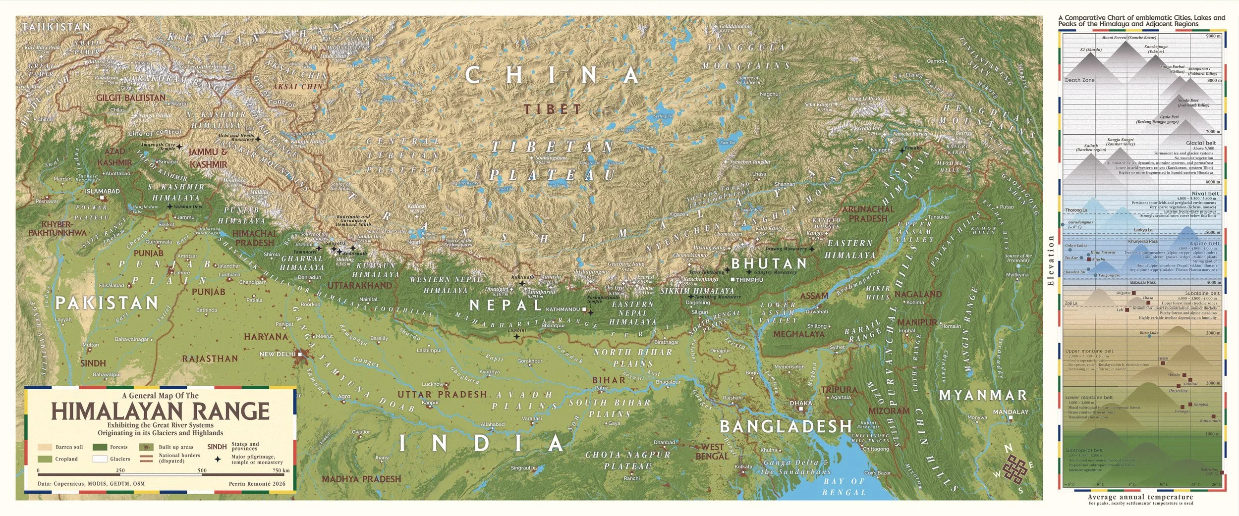
From the craggy, towering peaks of the Karakoram near the Afghan border to the lush Hengduan Mountains of China, the Himalaya stretch for more than 2,400 kilometres. This breathtaking mosaic of landscapes, sacred caves, peaks and lakes naturally calls for a custom map.
After making this map, I can safely say that mountain regions are nothing more than gigantic Russian dolls. First comes High Mountain Asia, often called the "Water Tower of Asia" because many of the continent's major rivers originate there, fed by glaciers and snowmelt.
As soon as you open that large doll, you find the Himalaya, the Karakoram, the Tibetan Plateau, the Trans-Himalaya the Hindu Kush and many other mountain systems. Open the Himalaya doll and you'll discover the Kumaun Himalaya, the Assam Himalaya, the Kashmir Himalaya, the Punjab Himalaya, not to mention the Shivalik Hills, the Mahabharat Range and countless smaller dolls nested within the larger one.
Three dolls in, we reach the valley scale: the Ganga, Yamuna, Yarlung Zangbo (Brahmaputra), Teesta and Koshi valleys. Then comes the ultimate and smallest doll of the set: the tributary valleys, with their villages, temples and terraced fields.
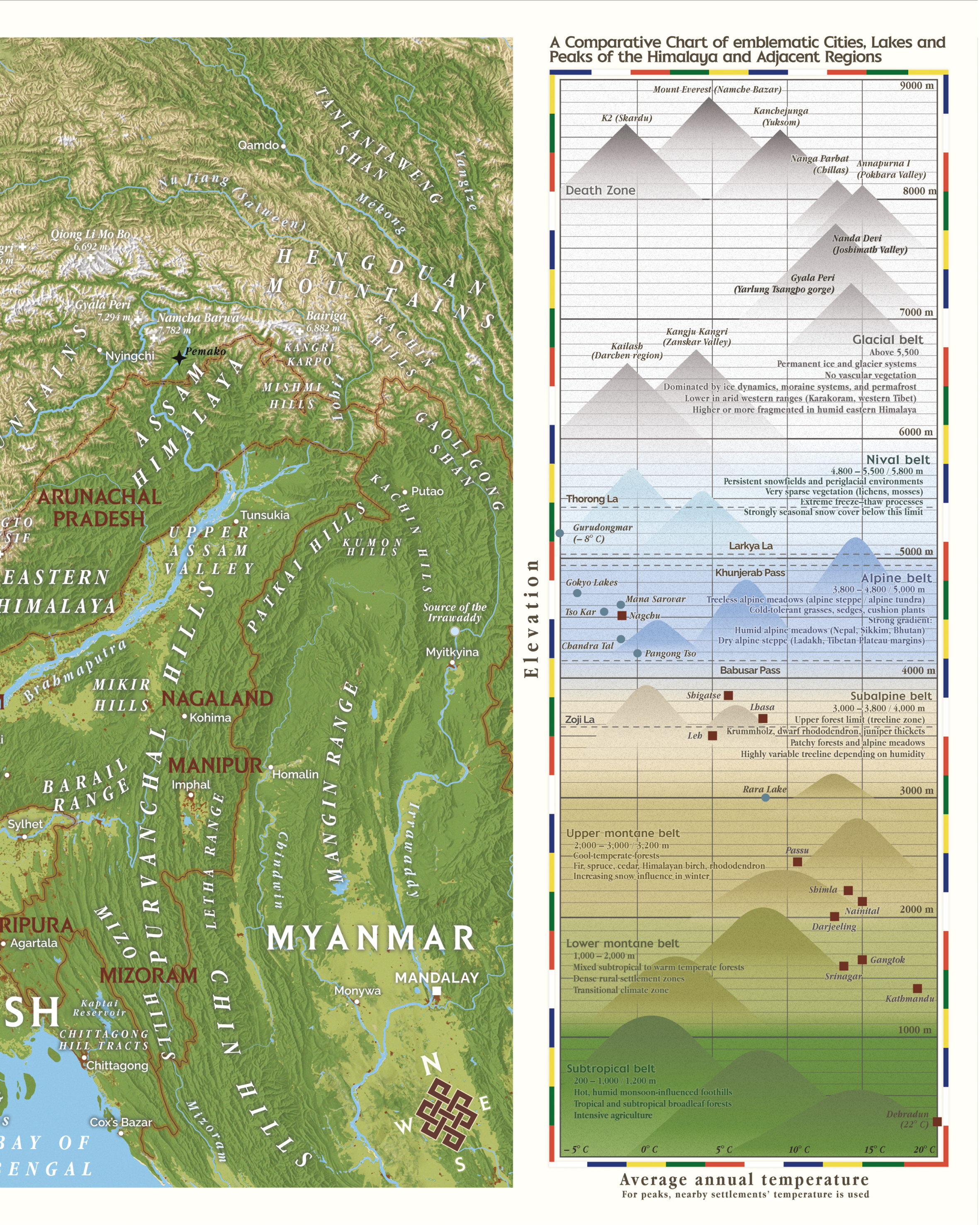
What I'm saying is nothing new—geography is, in many ways, a matter of scale.
Someone whose ideas were not only new but revolutionary was Alexander von Humboldt, to whom I wanted to pay tribute through this map. For many geographers, Humboldt remains a role model. He helped lay the foundations of modern ecology, revolutionized geography with concepts that still underpin the discipline today, and wrote about the damaging effects of colonialism and resource extraction on both environments and societies in the early nineteenth century.
Von Humboldt is best known for his travels in the Andes, where he made many of his most important discoveries. He was a man deeply passionate about mountains and longed for them throughout the rest of his life after returning to Europe.
Yet he never managed to visit the Himalaya. Unlike the Spanish authorities, who had allowed the polymath to travel widely through colonial South America, the British denied him permission to enter their Indian territories.
My own version (shown on the right side of the map) is an attempt to do for the Himalaya what Humboldt did for the Andes. It presents the different ecological belts—subtropical, lower montane, upper montane and beyond—alongside the altitude and average temperature of some of the region's most famous cities, lakes and peaks.
Lastly, two details I couldn’t resist adding: the tibetan prayer flags around the title box and diagram, a familiar sigh to anyone who has been to the Himalaya, from Ladakh to Assam and the endless knot, a powerful symbol rooted in the Hindu, Jain and Buddhist traditions.
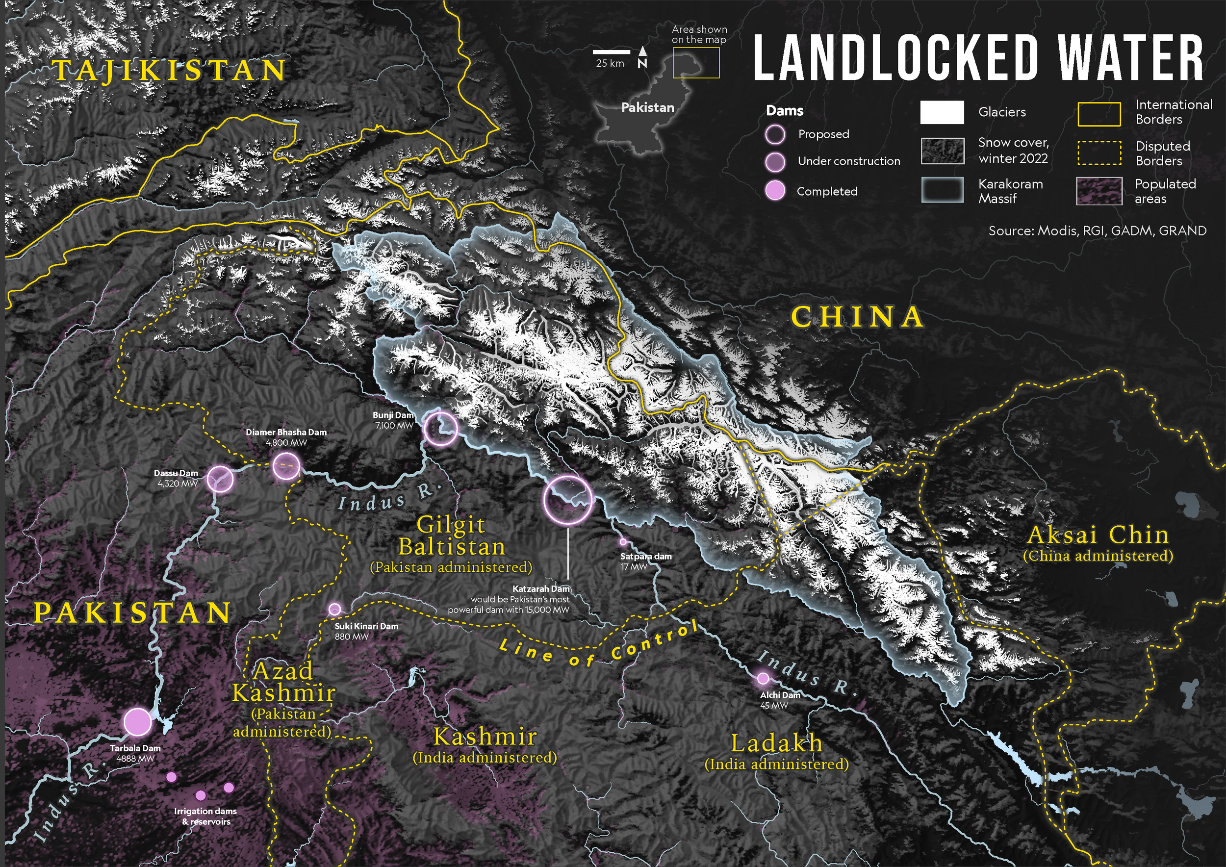
In august 2022, following a group of glaciologists, I visited Pakistan for the first time and headed to the Karakoram mountian range, nicknamed the “Third Pole” for the prodigious amount of ice it holds and lets run free every spring and summer, making the region’s glaciers the livelihood of hundred of millions living downstream in the plains of Pakistan. This adventure in what is called High Mountain Asia, the montaineous heart of the continent that holds incredible quantities of water, was life-changing.
I first came to document the glaciologists’ work with my camera and practice
my Urdu on the side but it made meet fabulous people from North Pakistan, gave me the opportunity to craft my first “real” map and dig deeper in geography and South Asia, much deeper than ever before.
I gathered all my photos, observations and maps in an article that tries to shed some light on the growing water issue that not just Pakistan, but its indian neighbour are facing.
You’ll find everything in the link below!
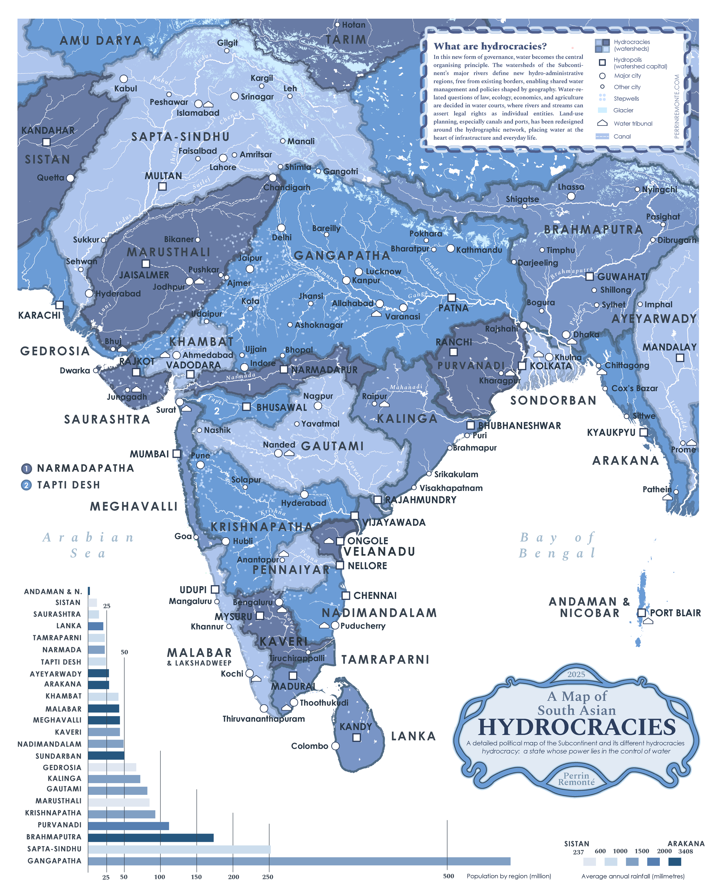
Borders are divisive by essence. Any effort to create the most balanced, fairest, ‘best’, border will inevitably yield a flawed, unsatisfactory, ‘least worst’ result.
Anyone who studies geography will be quick to understand why and for those who don’t, I feel it is the cartographers’ duty, my duty, to show them how borders will always be a trade off, an imperfect solution.
The subcontinent provides a good example of that trade off — a colonial power creating borders out of religious identity and the new states basing their regions on local languages. Most of these borders are not older than a century, yet they feel firmly locked today.
But others ways are possible. What if borders were based on watersheds, the area comprising the reaches of a river network? River catchments are the opposite of locked, they allow a natural flow and tackle the growing problem of water resources.
Again, that would be a trade off and a ´least worst’ type of borders, but this map is not an attempt to propose new ones. It is more of a thought experiment, a fictional geography venture to talk and think about water and how modern borders are oblivious to it, even though South Asia’s water insecurity is growing rapidly : melting glaciers, depleting aquifers, dams and rising water consumption.
The map features traditionnal embroidery patterns from Balochistan and Afghanistan, echoing the centuries of nomadic tradition, handicraft and artistic expression shaped by the intense exchanges across the region.
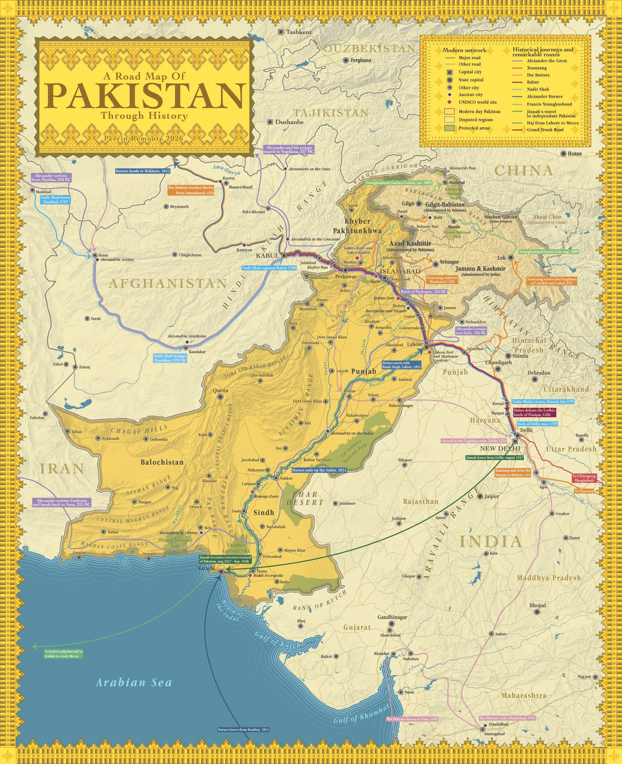
What is now Pakistan has truly been an extraordinary crossroads throughout history, and we may need a map to fully appreciate it.
At first glance, this appears to be a typical road map: it shows Pakistan, its borders, cities, roads, notable sites, and topography, along with neighbouring countries and disputed territories. But this map offers an additional layer of interpretation...
A road map is generally designed to help travellers navigate a place by showing roads and routes. But what if it could also tell the story of famous journeys from the past?
This is exactly what this map does by showing the route taken by iconic historical figures, all tied to different eras and cultures, with different purposes also.
From the macedonian army of Alexander the Great -or “Sikander” as he is widely known is South Asia- to Muhammad Ali Jinnah, the father of Pakistan, centuries of travelers, invaders, pilgrims, diplomats and explorers have trodden the vast expanse of land that is now Pakistan.
king Nadir Shah who famously travelled to Delhi and looted the city, Alexander Burnes, a 19th century british explorer and diplomat sent to meet the king of Punjab, survey the Indus and explore Bukhara, the 19th geographer and officer Francis Younghusband, a key player of the Great Game and finally, Jinnah, Pakistan’s founding father who flew to Karachi to serve as the young nation’s first Governor-General.
Two more routes are featured on the map: the 2,500 year old Grand Trunk Road, linking Kabul and Chittagong, in Bangladesh and the ancestral route for most Pilgrims in the region going to Mecca.
From West to East, North to South, from the tall, white mountains of the Karakoam to the arid coast of the Arabian Sea, this map features in detail the itineraries and stories of some fascinating characters.
First, there is Alexander the Great and some of the 70 cities he founded on his travels, as well as his battles, the 7th century chinese monk Xuangzong on his way to Nalanda from China, the 14th century moroccan traveler Ibn Battuta who stayed as a Qazi at the Tughlaq Court and escaped death many times, the founder of the Mughal dynasty, Babur, hailing from Central Asia, the Persian
More Maps